Weather Warning
IDD21013
Australian Government Bureau of Meteorology
Northern Territory
Heatwave warning
Issued at 2:43 AM CST on Sunday 14 Dec 2025.
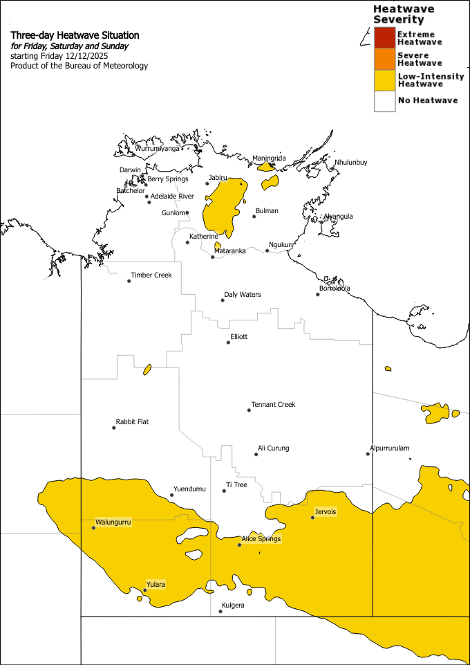
Heatwave Situation for day 1
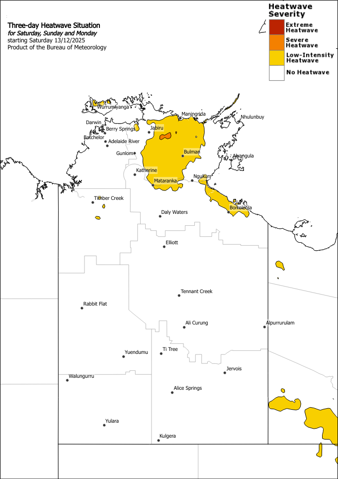
Heatwave Situation for day 2
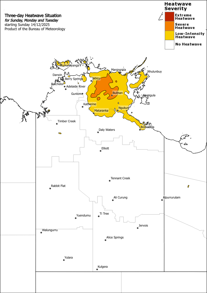
Heatwave Situation for day 3
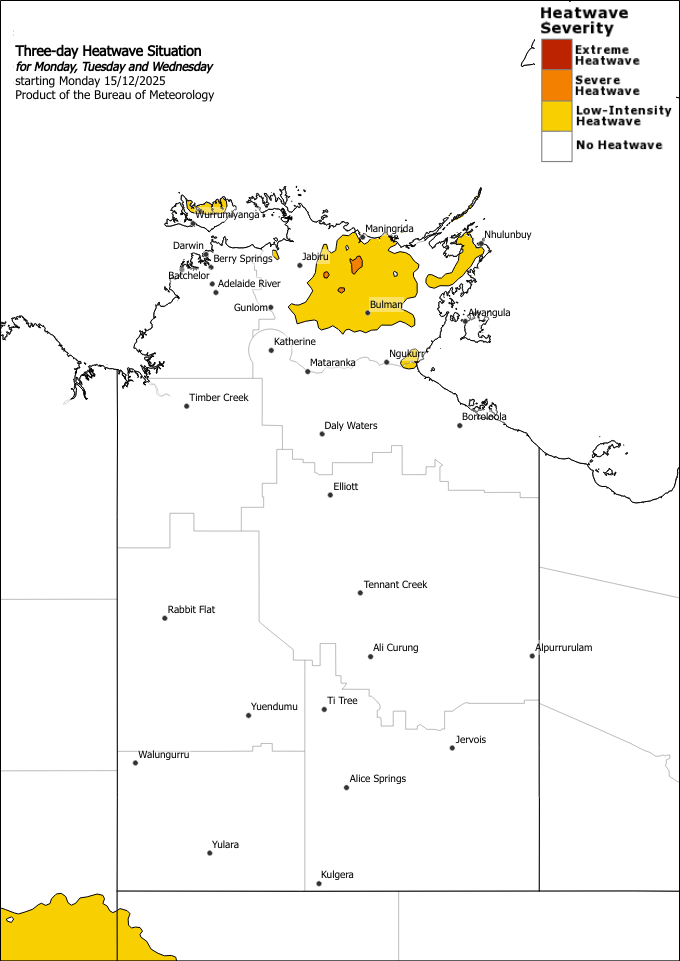
Heatwave Situation for day 4
Maximum temperatures over the eastern Top End in the high thirties to low forties and overnight minimum temperatures in the mid twenties. Maximum temperatures over the southeast of the NT have eased to range from the mid thirties to low forties and overnight minimum temperatures in the low to mid twenties. Severe heatwave conditions over northeastern NT are expected to remain until mid week. Severe heatwave conditions have eased over the Simpson district, however low intensity heatwave conditions may linger for a day or two. Locations likely to be impacted include Bulman.
Safety Advice:
- Severe heatwaves can be dangerous for many people, especially older people, babies, children, pregnant and breastfeeding women, people with medical conditions and people who are unwell.
- Seek a place to keep cool, such as your home, a library, community centre or shopping centre.
- Close your windows and draw blinds, curtains or awnings early in the day to keep the heat out of your home.
- If available, use fans or air-conditioners to keep cool.
The next heatwave warning will be issued by 3:00pm CST on Monday 15 December 2025